Date/Time
Date(s) - Wed Jul 10 2019
8:30 am
Notes:
On the Icefields Highway, the pass beyond the end of Bow Lake is the watershed divide for the N. and S. Saskatchewan River systems (Patton&Robinson). Views are very fine from the end of the old road track which once led to the highest fire lookout in Banff Park. (track starts above the parking lot for Peyto Lookout.) From highest point of the day one sees in one direction Bow Lake & glaciated peaks, and in the other, from Peyto Lake into the Mistaya Valley and Waterfowl Lakes.
First car stop will be at the near end of Bow Lake to enjoy both a large snack and the sound of the lakewater lapping on the pebble shore. We’ll skip Num-Ti-Jah Lodge (unless on the way back) and go on to the trail head. Plse bring lots of water, sun protection, and warm wind-proof jacket in case of cool breezes both by the lake and higher up ; bear spray if you have it. (Bears now & then move from one valley over the pass to the other, but discreetly).
Type: Hike
Level: C at C pace
Trip Leader: Jean Finley
Total Distance (km): 3
Vertical Gain (m): 230
Max Elevation (m): 2315
Duration (hrs): 8
Meet 10 minutes before 8:30 AM
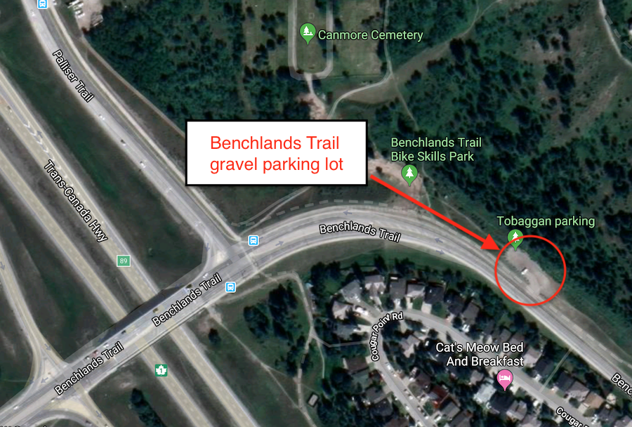
Meet location: Benchlands Trail parking
Cost ($): 8
Max Participants: 7 CANCELLED
Signup: MUST SIGN UP
Earliest Signup: 8:00 pm Wednesday before trip
To register, email request to: strengthener7@gmail.com
Include your CSA MEMBERSHIP number and a contact PHONE number
If no reply check your email junk folder
# Hikers: