Date/Time
Date(s) - Wed Jul 10 2019
7:45 am
Notes:
From & back to Ribbon Creek.
Flowers in the meadows should be amazing!
Highest trail in the Canadian Rockies, built by the Rocky Mountain Ramblers for 1967 Centennial.
Type: Hike
Level: A
Trip Leader: Patty Glover
Total Distance (km): 16
Vertical Gain (m): 1350
Max Elevation (m): 2820
Duration (hrs): 8-9
Meet 10 minutes before 7:45 AM
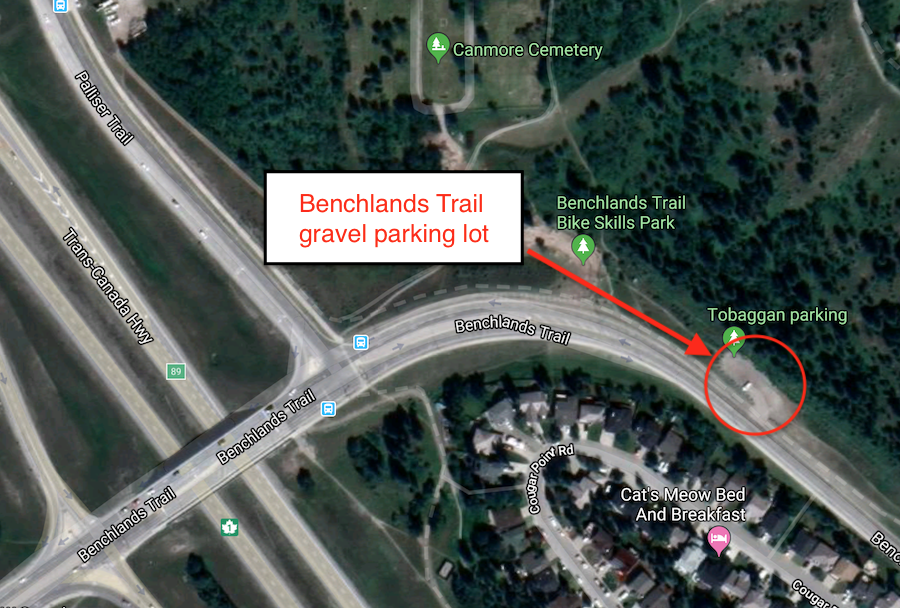
Meet location: Benchlands Trail parking
Cost ($): 7
Max Participants: 12 FULL
Signup: MUST SIGN UP
Earliest Signup: 8:00 pm Wednesday before trip
To register, email request to: p.glover@shaw.ca
Include your CSA MEMBERSHIP number and a contact PHONE number
If no reply check your email junk folder
# Hikers: