Date/Time
Date(s) - Wed Jun 26 2019
8:00 am
Notes:
Peaks 427439 & 436425. Daffern’s 4th edition, vol 2 pg 211.
Off-trail, some steep areas, some easy bushwhacking but mostly open. Flood did a lot of damage in this area so some rock hopping in the creekbed. These are the 2 closest peaks to the parking area.
Type: Hike
Level: A
Trip Leader: Patty Glover
Total Distance (km): 12
Vertical Gain (m): 750
Max Elevation (m): 2356
Duration (hrs): 8
Meet 10 minutes before 8:00 AM
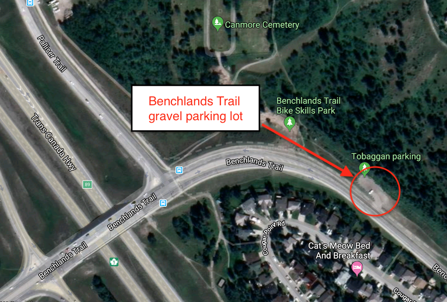
Meet location: Benchlands Trail parking
Cost ($): 10
Max Participants: 12
Signup: MUST SIGN UP
Earliest Signup: 8:00 pm Wednesday before trip
To register, email request to: p.glover@shaw.ca
Include your CSA MEMBERSHIP number and a contact PHONE number
If no reply check your email junk folder
# Hikers: