Date/Time
Date(s) - Wed Jul 10 2019
9:15 am
Notes:
The hike to the Stanley Glacier basin is relatively easy and often a C hike. We route find across a rocky slope and travel about 1 km across a scree slope path to the Ridge. This adds about 2.5 km to the hike and some elevation.
Type: Hike
Level: B
Trip Leader: Paul and Nancy D'Agostino
Total Distance (km): 11
Vertical Gain (m): 500 approx.
Max Elevation (m): 2100 approx
Duration (hrs): 7
Meet 10 minutes before 9:15 AM
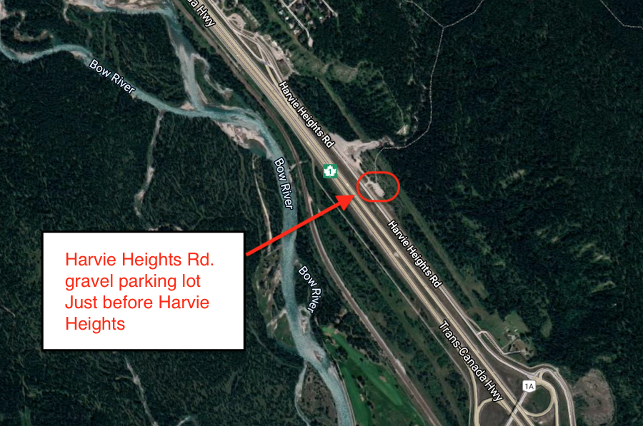
Meet location: Harvie Heights Rd gravel lot
Cost ($): 8
Max Participants: 10 FULL
Signup: MUST SIGN UP
Earliest Signup: 8:00 pm Wednesday before trip
To register, email request to: dagostino@shaw.ca
Include your CSA MEMBERSHIP number and a contact PHONE number
If no reply check your email junk folder
# Hikers: